Friday, October 8, 2010

Wear/Whereabouts

The site exists in a lineage of America's history of forging new ground and crossing frontiers.  The memory of place exists as the operational site.  For the coyote there is no gps or map to tell them where to go, it is all about memory and reading the land.  Its takes a certain level of knowledge to be able to see.  This continual bed of knowledge of the landscape and the trail network exists in the collective memory.  This collective memory is the catalyst for the migration to occur.  It is only through the previous experience of the place that the guide then knows how to navigate.  It is a continual process of reading the land and recalling memories of place.  Whether they notice the smell, the dense mesquite, a certain tree, or the shape of the mountains it is all linked to memories of the land.  

This network of migrant trails is a residue left behind.  There are patterns of movement and traces which have an alternate effect on the land. The traces can be viewed in relation to other historical trails: The Oregon Trail, The Mormon Trail, The Underground Railroad.  Arizona's Migrant trails will also be remembered in the collective history of politically charged territories.  

There are two chapters to my story:  Navigating Landscapes and Residual Traces.  

Wednesday, October 6, 2010

Site as Thesis

Site_ The site no longer exists as a three-dimensional landscape, rather it is an occupation of memory.  Site is a continually evolving memory of experience, an alternate, reconstructed reality.  The memory is the instance which continues to be activated and recalled- not the topography lines of the changing land.  On the trails the terrain is rough and always changing. Individuals are no longer occupying merely the immediate visceral space, but their mental reconstruction of space.  For the guide a series of moments exist where memory is relied on, the site becomes the immediate view, the smell, the pattern of vegetation.  The walkers are going through the motions along a mountain trail, but their thoughts and memories are what keeps them moving and are what are occupying their minds.  The memory becomes the site for continual growth.  The knowledge of the guides is not documented in a map or special book which they carry with them.  The migrant trail infrastructure relies solely on the memory of place as the continual path of movement. Each walk north is different every time as following the same path is impossible without a gps.  The agents rely on the surrounding atmosphere, the sun and mountains, to point them in the right direction.  The experience is not one of a singular place rather a journey of the memory through time and space.

Tuesday, October 5, 2010

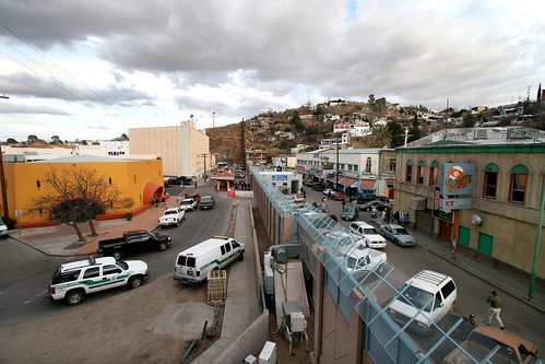
Border Wars-Nogales: City Under Siege

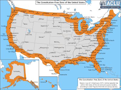
Constitution Free Zone


  • Normally under the Fourth Amendment of the U.S. Constitution, the American people are not generally subject to random and arbitrary stops and searches. 
  • The border, however, has always been an exception.  There, the longstanding view is that the normal rules do not apply.  For example the authorities do not need a warrant or probable cause to conduct a “routine search.” 
  • But what is “the border”?  According to the government, it  is a 100-mile wide strip that wraps around the “external boundary” of the United States. 
  • TWO-THIRDS of the United States’ population lives within this Constitution-free or Constitution-lite Zone.   That’s 197.4 million people who live within 100 miles of the US land and coastal borders. 
  • This illegitimate expansion of the extraordinary powers of agents at the border is also part of a general trend we have seen over the past 8 years of an untrammeled, heedless expansion of police and national security powers 

2010 Migrant Deaths in the Sonoran Desert

I just received this updated map of Migrant's Deaths in the Sonoran Desert along the Arizona-Mexico Border for 2010.  You can see the increasing deaths in the Tohono O'odham Nation.  The indian reservation is populated with migrant trails, and despite the deaths occurring on their land they won't allow humanitarian groups to drop water anywhere on the reservation.  In general they view that the water encourages more migrants to travel across their land. 

Immigrant Deaths allocated by Border Patrol Sector
provided by the Arizona Daily Star

The Tell Tale Trade [trailing networks]

Emigrant Trails
With my interest in the current Migrant Trails in southern Arizona, I am also connecting to a larger network of US history and our continually shifting population migrating across our own frontiers. The working migrant trail builds upon the history of other trails such as the Oregon Trail and the Mormon Trail.  


The Emigrant Trail is the classification or 'academic name' collectively applied to the easternmost common stretches of the northern networks of overland wagon trails throughout the near American West, used by emigrants from the eastern United States to settle lands west of the Sierra Nevada  and Rocky Mountains during the overland migrations in the middle and later 19th century.
For the emigrants, there was no fence to cross rather they were faced with crossing the frontier filled with mountain ranges and rough terrain.  


Oregon Trail (from the 1830s) 
Mormon Trail (from 1846), 
California Trail (from 1841)


The trail network has become embedded in the folklore of the United States as one of the significant influences that have shaped the content and character of the nation. The remains of many trail ruts can be observed in scattered locations throughout 
arid parts of the American West. Travelers may loosely follow various routes of the trail network on modern highways through the use of byway signs across the western states.
Up to 50,000 people, or one-tenth of the emigrants who attempted the crossing, died during the trip, most from infectious disease such as cholera, spread by poor sanitation. Hostile confrontations with Native Americans' defending their homelands, although often feared by the emigrants, were comparatively rare. Most emigrants traveled in large parties or "trains" of up to several hundred wagons, usually led by an experienced guide.

Sunday, October 3, 2010

Temporary Migrant Housing & Tunnel Infrastructure

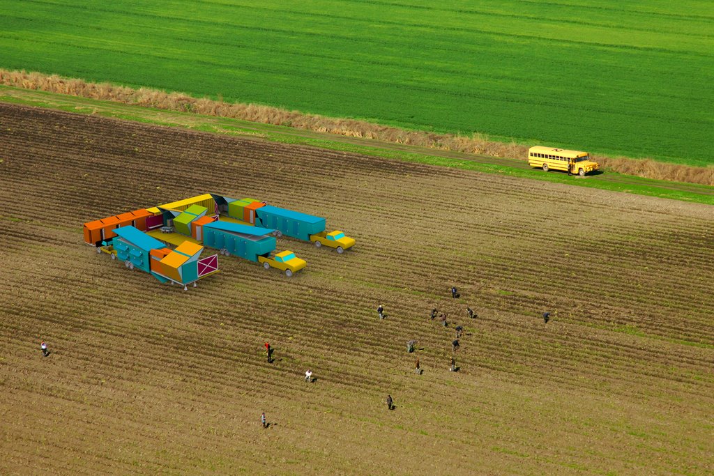
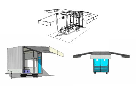
Bryan Finoki of the blog SUPTOPIA looks into developing migrant farm worker housing as a new public infrastructure.  

Digging Into America: Migrant Tunnels, the new underground railroad 
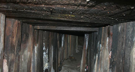
"As you may or may not know Nogales, Arizona has quickly become the border tunnel capital of North America, as in illegal cross-border tunnel, at least as far as the U.S. government can tell. The latest numbers according to a NORTHCOM Task Force briefing that was apparently secretly leaked over the web just weeks ago, indicate between 1990 and November 2008, 93 cross-border tunnels were discovered, 35 of which were in California, 57 in Arizona, and 1 in Washington State" _subtopia
Nogales,US-Nogales,Mexico

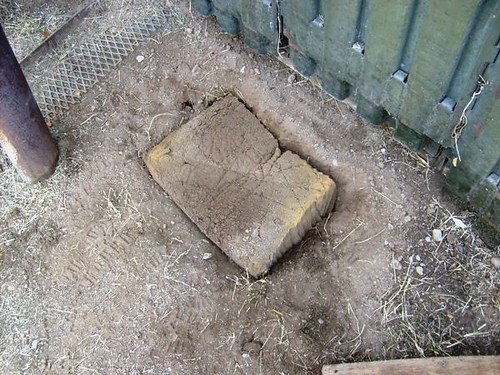
Tunnel Entrance
"The watershed infrastructure and all its subset tunnels that wander under Nogales on both sides of the border are so vast perhaps the only way to truly gage the number of secret unaccounted-for passages that poke, spoke, and meander through it would be to airlift the entire structure (at the core two parallel concrete tunnels roughly fifteen feet wide and several miles long), scooping and dislodging it and plenty of surrounding earth (houses, city sewage tunnels and all) from its site fixed under the border, and dunking into some sort of nearby tank the size of at least twenty square city blocks filled with liquid foam core, then to delicately remove the infill tendrils later and see what extracted void sculpture you might be able to use to extrapolate a visualization of the smaller informal tunnels that violate the whole thing."  _subtopia

I'm itching to look into this tunnel infrastructure as well as another piece of the migrant trail