Tuesday, November 9, 2010

Maps are not Neutral


Connie Brown, mapmaker, at Gel 2010 from Gel Conference on Vimeo.


Cartography, says Connie Brown, represents a marriage of art and science. She paints one-of-a-kind maps on canvas for private clients, companies, and organizations. Her one-off painted maps show not just geography but perspective. In her 20-minute presentation she shows how maps are both descriptive and opinionated. Here Connie displays many different types of maps and describes what excites her about mapmaking.

Journalism in the Age of Data


Journalism in the Age of Data from Geoff McGhee on Vimeo.

CREDIT http://www.chryswu.com/blog/

La Caminata

CLICK for MOVIE


Its not about creating a spectacle, but about arising consciousness. 


A small town south of the Mexican border decides to take control of their own community and stem the tide of migration to the US
Seven hours south of the US/Mexican Border lies the small town of Alberto, where the  local community, like many pueblos across Mexico, has lost 80 percent of its population to migration into the United States. But Alberto has a plan to revive their community, the creation of a theme-park event - a simulated border crossing, complete with balaclava-clad “coyotes” as guides and “border patrol” that chase “migrants” up and down rough terrain through the night. They call this event the Caminata (translation: journey, hike, trek). The organizers designed the experience as a tool for compassion and consciousness-raising, showing the largely middle-class Mexican tourists who attend the difficulty and dangers faced by those crossing the border. Through an exploration of this unique journey, La Caminata adds a fresh perspective to the ongoing debate on immigration: that of Mexicans actively fighting poverty, joblessness, and desolation in their home communities.

Wednesday, October 27, 2010

Operating on Fact

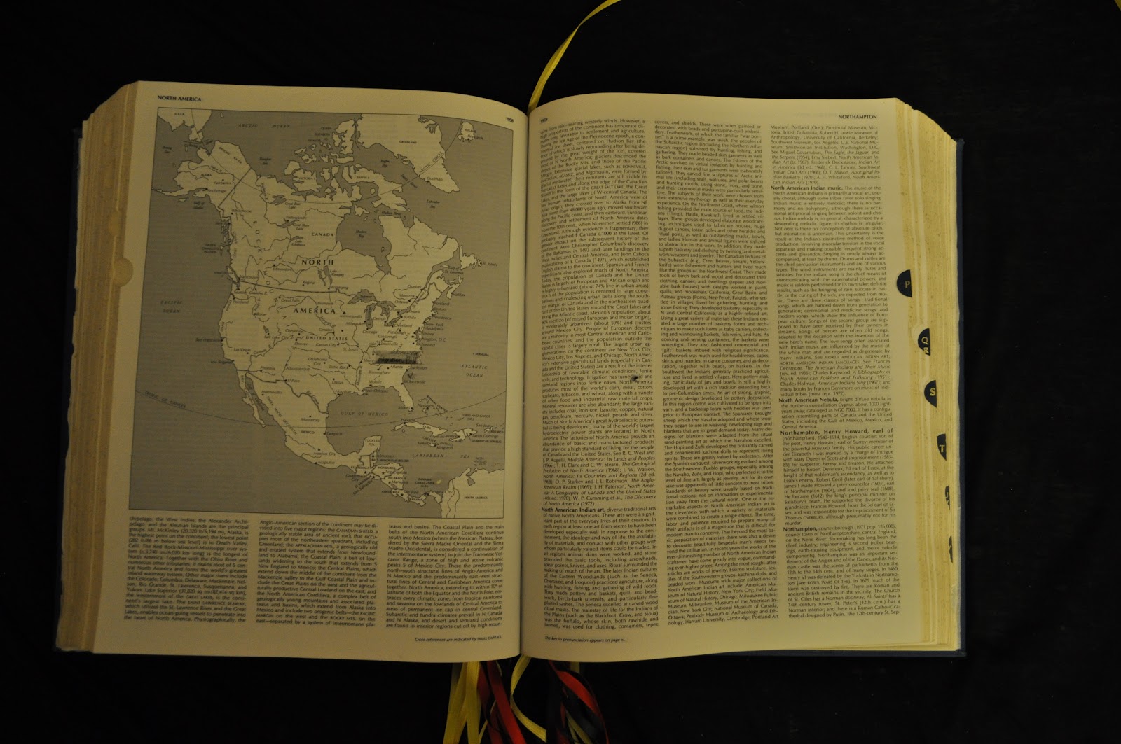
en·cy·clo·pe·di·a  [en-sahy-kluh-pee-dee-uh]       –noun
a book or set of books containing articles on various topics, usually in alphabetical arrangement, covering all branches of knowledge

The encyclopedia acts as a concrete artifact which is altered to re-intrept so-called ‘factual’ information.   Through tracing, extracting, and plotting the book begins to operate as the thesis.  Operating within the encyclopedia question how history is documented and re-told.  While it can be argued that the encyclopedia is a book of facts or book of fiction, it is accepted as general knowledge of events, places, and people.  The encyclopedia is then a map in itself, documenting common knowledge to propel human cultures.  Using the academic and artistic references, each operation situates itself into the encyclopedia. 


MOVE I. re-tracing words_ [fill in the blanks]


printed law _______ life
government regulating ______ flow
hunting _____ legal american 
material marks home 
bubbles of idealization ____
masses ____ knowledge ____ war
coexistance ______ brown _____ banned
citizens _____ condition _______ reproduce
buildings _______ formality ______architecture

Reading across topics and information presented on a given page to read a second code of information that is being presented.  Questioning the words used to present facts.  


MOVE II.  mapping agency, (insert)
A new article is added in between map and map projection which defines the agency of mapping according to James Corner.  It references back to inserts Guy Debord, extract, field, and plotting. 

MOVE III.  frontier, (re-define)
Working off of the thesis’ lexicon of terms, a new explanation of frontier is inserted.  The previous explanation defines frontier in relation to the movement out west with example frontier as ‘the mining frontier’ ‘the fur trade frontier’ and ‘the gold frontier’.  The new definition defines the frontier as a boundary, a line of control which exists as a cultural understanding not as a physical boundary.  

MOVE IV.  tracing migrant labor (insert, overlay)
Three different explanations of migrant labor are inserted adjacent to the 1975 Encyclopedic explanation.  The other excerpts come from a the Oxford Companion to U.S. History (2001), the Columbia Encyclopedia (2008), and Wikipedia, (2010).  This move allows one to trace how history redefines and proves how presented facts are actually interpretations that are always changing.  

MOVE V. framing migration (cut)
Through removing information the migration is now able to be viewed within the context of North America, the most notable content of migration.  


MOVE VI. realign the railroad (cut)
Cutting through the pages allow for a new connection between topics.  Instance such as the ‘underground railroad’ and ‘railroad’ which self reference each other in their explanations can now be viewed simultaneously as one is always informing the other.  Trail and trace can also be viewed within this move as thesis looks at tracing these historical events and the effect of trails.  

MOVE VII. trail (re-define)
Previously explained as a city, trail is not understood in the terms of the thesis as a residue left behind. They are patterns of movement of the people and animals which have left a mark on the land.  This definition references King Peter’s ‘Seven Trails West’, Pereguine’s ‘Ancient Human Migrations’ and Nash Smith’s ‘Virgin Land’.

MOVE VIII. what is war? (re-arrange)
Through cutting up an re-arranging the text explaining ‘war’ you can no longer understand what it is and why it occurs. It forces the reader to define for themselves what war is.

MOVE IX. concealing government (cover-up)
All you need to know about the government is that it has power over you.  The rest of the explanation is covered with black tape and only reveals the word power.  

MOVE X. World War II (lettering)
The narratives of the events of WWII are more valuable than the description of the who won what battles and what countries fought whom.  Therefore inserted over the explanation are excerpts from a trail of letters during the war. Choosing to remember the narrative has significance and implications in collective interpretation and memory.  

Tuesday, October 19, 2010

Shifting Scenes


Monumental shifts in traditional frameworks of thought and theory lead to the creation of new paradigms.  Operating across history, architectural periods, and text our work questions reality and fiction.  The scale moves from the most concrete reality of the existence of a site to the shift in the author’s role in (re)defining the site, to the representation of a fictional narrative through image or text.  Lines connect from the reality-fiction scale to methods of narrative and historical moments.  When these lines intersect a fictional text is generated which operates in the narrative method and time period being traced.

Trailing Signs

Architects such as Fernando Romero and Teddy Cruz have published architectural proposals that challenge the current state of the U.S-Mexico Border. Cruz’ practice challenges the aesthetics and qualities of life across both sides, arguing for an infiltration of the density existent in the Mexican barrios into suburban America. Fernando Romero from LAR re-appropriates the 2,000 mile long border, dissecting the political and social issues then projecting new futures. In his book HyperBorder he calls attention to the Border as a territory with the potential to be revived, rather than ignored. He recognizes the border’s importance and ability to alter both countries’ future, as Mexico and the United States are already heavily interdependent. Romero projects potential futures interventions which could alter, and arguably improve, the border as a megalopolis of cultural, social, and economic exchange. My position stands somewhat aside these two architects, as my interests lie along the U.S.-Mexico border. However, I am not interested in finding a solution or ultimate proposal to the very complex, heated, and layered political issues between both countries. What is important however is the current state of movement across the line. People, goods, and services are in a continuous flow North. There are two chapters to this story: Navigating Landscapes and Residual Traces.


Navigating Landscapes

Trailing Signs situates the movement and navigation along trails within a broader historical story. An estimated half a million migrants walk along the migrant trails in southern Arizona, traveling in groups with a coyote leading them through the desert. For the coyote there is no GPS or map to tell them where to go, it is all about memory and reading the land. Its takes a certain level of knowledge to be able to see. This continual bed of knowledge of the landscape and the trail network exists in the collective memory. This collective memory is the catalyst for the migration to occur. It is only through the previous experience of the place that the guide then knows where to navigate. It is a continual process of reading the land and recalling memories of place. Whether they notice the smell, the dense mesquite, a certain tree, or the shape of the mountains it is all linked to memories of the land.

Residual Traces

This migration pattern sits within a historical context of humans migrating and crossing frontiers, particularly in America. The trails are a residue left behind. They are patterns of movement and traces that have an alternate effect on the land. The traces can be viewed in relation to other historical trails: The Oregon Trail, The Mormon Trail, The Underground Railroad. Arizona’s Migrant trails will also be remembered in the collective history of politically charged territories. The Underground Railroad’s quilts are a collection of waypoints, which aided in navigation, but still had existence after the historical event, hence acting as traces from the past.


Through the act of layering multiple agents, trails, networks and catalysts the work digests multiple data and patterns into new systems of organization. Working along side Edward Tufte and James Corner the maps develop new visual connections across cultural, social, and statistical patterns. The collection of mappings becomes a living three-dimensional object, as movement is in a continual state of flux yet always referencing the past. The historical will always be present in the mapping of the current. Layers of political, social, and urban infrastructure are connected to the historical migrations of people, goods, and services along the networks of roads, rail, and rivers. The work takes into account political policies such as NAFTA, as a control of movement across the two countries.

The collection of maps is stored in a book, along with collected research and data trails. The maps sit between a written historical narrative of trailing and a projective architectural scenario which exploits the systems revealed by the mappings.